1960
Ecological studies on rain forest in Northern Suriname
Publication
Publication
Mededelingen van het Botanisch Museum en Herbarium van de Rijksuniversiteit te Utrecht , Volume 163 - Issue 1 p. 1- 267
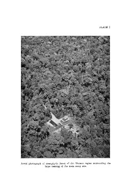
During the years 1955-1957 ecological data were collected in various types of mesophytic forest occurring in the northern half of central Suriname (fig. 1). Physiognomically as well as floristically these forests correspond with the type of vegetation which in the other parts of tropical America generally is designed as the “rain forest formation”. The main points of investigation were: (1) the environmental factors prevailing in mesophytic forest, more particularly in connection with the regeneration of tree species; (2) the variation in the floristic composition of some stands belonging to this formation; (3) the mode of regeneration of a number of valuable timber species under natural and artificial conditions. The first chapter deals with the general climate in northern Suriname, which is primarily determined by the distribution of the rainfall. Although (except for a narrow drought belt along the coast) the amount of total yearly reainfall is rather high (fig. 10), the distribution of precipitation is distinctly seasonal (figs. 4-9). The annual march of atmospheric humidity, air temperature and daily amount of sunshine are strongly correlated with that of the rainfall (figs. 4 and 31). Consequently, for a number of tree species flowering, growth and leaf fall also show a distinct periodicity. From an ecological point of view especially the length and the severity of the yearly period(s) of drought are of importance. To that effect the rainfall data obtained from the meteorological stations were worked up according to a method for estimating the climatic effectivity of precipitation as recommended by MOHR. By this method—instead of using longterm monthly averages-for each year of the period of observation the number of dry months is determined separately (fig. 8, table I). The average number of dry months per year obtained in this way provides the ecologist with more rehable figures than e.g. the Köppen method does, which works with long-term averages and which, moreover, gives no weight to the length of the dry season(s). In default of empirical data on water requirements of the vegetation in Suriname, in our provisional classification of the rainfall stations in N Suriname, a month is called dry if the total amount of rainfall is less than 60 mm, and wet if the latter exceeds 100 mm. These critical values are based on the outcome of studies carried out elsewhere in the tropics. The 100-mm limit is supported to some degree by data on potential evapotranspiration and discharge values in the basin of the Upper-Suriname R. Applying this method to N. Suriname the average number of dry months varies for most of the stations (with exception of the narrow coastal belt) between 1.5 and 1.8 per annum, the short dry season comprising 0.3-0.5 months, the long one 0.9-1.4 months. A disadvantage attaching to this method is the obscuring effect of the averaging upon the strong variation in the severity of the yearly period(s) of drought with its intendant fluctuations in the yearly total amount of rainfall. The years of great drought, although occurring exceptionally and irregularly (figs. 6 and 8), probably are a differential factor of considerable ecological significance, which strongly accentuates the differences in available soil moisture existing between soils with different texture and drainage. Moreover, these severe drought periods may exercise an indirect influence upon the vegetation because they create conditions favourable to extensive fires due to human activities. Accordingly, for a better characterization of the dry periods a method was used which is described in detail; an essential feature of this method is the calculation of 30 -days’ moving totals, which are set out graphically in figs. 7-9. A day is tentatively called dry when in the preceding 30 days less than 60 mm has been recorded. For the station Republiek the length of the longest yearly dry period varied in the last 50 years between 0 and 105 days (fig. 8). When the narrow coastal belt is left out of consideration, it appears that the differences in over-all climate, viz. air temperature, total rainfall per annum and climatic effectivity of rainfall (as determined by each of the above mentioned methods), show from an ecological point of view but little variation for the stations in N Suriname; the marked differences in aspect as well as in floristic composition shown by the forest in this region are, therefore, certainly not due to these climatic differences. In the following chapters of the first part the methods and the results of the micro-climatic studies are discussed. The measurements give a picture of the daily and seasonal variation observed during two full years and during the very dry season of 1957. Light intensity (in the range of ca 3500-8500 Å) was measured at different heights in the undergrowth of mesophytic and of xeromorphic forest and in a large clearing by means of a spherical photometer (fig. 12). The advantages and limitations of this method are described in 1.3.2. The “daylight factor” (i.e. the ratio between illumination inside and outside the forest) in the undergrowth averaged roughly 2 %; for “vertical illumination” (as measured with a plane-surface photocell, held in a horizontal position) this factor approached a value of 3 %. These figures are considerably higher than those recorded for mesophytic forests elsewhere in the tropics. This is partly due to the fact that other investigators only measured “shadow light” and left patches of bright light out of consideration. The argument that the latter should be left out of the sets of readings because (1) the plants of the undergrowth are adapted to low light intensities and are unable to profit by short bursts of strong light, and (2) above a certain limit the photosynthetic effect of light falls off progressively with increasing intensity, are based mainly on the results of laboratory studies on photosynthesis of individual plant organs or cellsuspensions, which should not he applied unreservedly to whole plants or communities. A few preliminary observations made on the growth of seedlings and saplings of woody species from the Suriname forest gave indications that their growth rate does not approach asymptotically to a limiting value lying below that of full sunlight; all of the species which were investigated showed their maximum growth at full light in large clearings. The method of sampling light intensity in the forest that was used in the present study was discussed in detail in 1.3.3; samples were systematically taken along random line transects and, accordingly, included both the enormous spatial as well as temporal variations in light intensity that are encountered under a vegetational cover of complex structure (cf. table II and figs. 14-18). Examples of the results of many series of readings are given in table II and are shown as frequency polygons in figs. 15 and 18. For the computation of the average daily march of mean light intensity at different levels in the forest (figs. 16 and 17) the arithmetic averages of the series of readings have been used (cf. 1.3.2). Total illumination, as measured with the spherical meter, at ½ m height in mesophytic forest, averaged 12 x 103 ergs/sec/cm2 0 between 7 and 17 hr. in the dry season (i.e. during days with the sun unobscured during ca. 85 % of the time). For the plane-surface photometer (vertical illumination) a value of 8 x 10³ ergs/sec/cm2 was computed. The average daily amount of luminous energy received during such days by the undergrowth (at 1½ m) was ca. 22 x 107 ergs/cm2 ø (15 x 107 ergs/cm2 with a plane-surface meter). A rough estimate of the spectral composition of the illumination in the forest was made by means of measurements made with a plane-surface meter and 3 glass filters (red, green, yellow, cf. fig. 11). The results of the measurements (cf. 1.3.5) indicated a considerable increase in the blue and violet end of the visible spectrum (ca. 3500-5000 Å) and also an increase in the transmission of the forest canopy in the red part beyond ca. 6100 Å (fig. 19, table III). The blue-red shade found in the undergrowth of the Mapane forest, corresponds in its spectral composition to the shade light found in African forests and in some deciduous forests in temperate regions. Atmospheric humidity and evaporation at various levels in mesophytic forest and in the open were discussed in the sections 1.4 and 1.5. The variation in these factors closely followed the rather irregular pattern of rainfall distribution. Though humidity reaches its minimum during the long dry season, even during this season dry periods are interrupted regularly by periods consisting of one or more humid and wet days, whereas the 8 wettest months are frequently interrupted by successions of rainless days (figs. 7-9, 30, 35). Accordingly it is difficult to find a general characterization of the march of humidity at various sites, and reference must be made to the graphs which are reproduced in figs. 22-36. The humidity records for the various sites and seasons resemble each other in the presence of a long nightly period in which humidity approaches or reaches saturation; even at the height of a very dry season, during the driest day on record, in the forest undergrowth saturation deficit dropped below 2½ mm (rel. humidity rose above 90 %) during 9 hrs. (fig. 28). In the 8 wettest months of the year saturation deficit in the undergrowth (at 1½ m) only rarely rose above a value of 6 mm (rel. hum. fell below 80 %) for more than one hour per day. During drought periods humidity can drop to rather low values even in the mesophytic forest (figs. 26-29, 33) and a saturation deficit of 15 mm (rel. hum. 55 %) was not seldom recorded. From readings made simultaneously in an extensive clearing in the forest, it appeared that the humidity, evaporation and temperature prevailing in the two stations resembled each other very closely, and accordingly the records for the clearing are considered to represent also the atmospheric conditions just above the canopy. It appeared that in the dry season(s) saturation deficit in the open could rise to considerable heights (figs. 23-25, 28, 32, 33); during the 8 wettest months it seldom reached a value of 12 mm (rel. hum. 60 %) for longer than ¼ hr./day, but during the 2 driest months the deficit generally rose above 12 mm (rel. hum. below 40 %) during at least 1 hr./day, and values above 20 mm (rel. hum. 45 %) were recorded repeatedly during more than one hour on end. During a very dry season a deficit of 22 mm (rel. hum. 42 %) is reached nearly every day for at least 2 hours, thus approaching values similar to those reported in desert regions. Yet, even during the driest periods there is a long night period of high humidity (fig. 28). Although the atmospheric humidity of the rain forest in Suriname showed a lower average and reached considerably lower minima than e.g. in Africa, it is uncertain whether these differences are real, because the records from other forests probably did not show the full seasonal range of humidity (1.4.5). During the present study extensive use was made of a set of Piche evaporimeters, although we were fully aware of the limited value of data which are obtained with an instrument that by its nature can never fully integrate the effect of various stimuli to water loss in exactly the same manner in which this is done by plants. Yet the use of a mechanical device that measures the integrated effect of the various factors by which transpiration is promoted may provide data of great ecological value, notably for comparative purposes. The advantages and limitations of the values obtained with Piche evaporimeters were discussed in 1.5.1 and 1.5.2. It appeared that the readings of capillary evaporation, especially when averaged over longer periods, may provide a very convenient measure of the relative differences in atmospheric humidity in various habitats (figs. 30, 31, 34, 45). In the forest the seasonal differences in air temperature appeared to be rather small (fig. 31), owing to the small range of the seasonal variations in overall air temperature. The daily maximum in the undergrowth of mesophytic forest generally varied between 25° and 30° C, and the minima between 20° and 22° C. The data on air temperature have been summarized in table V, and are shown graphically in figs. 31, 37-40. The soil temperature under forest cover showed only very small seasonal and daily variations, and at a depth of 2 cm presumably never exceeds a value of 28° C. The data have been summarized in table V and are shown graphically in figs. 41-44. The maximum range of temperature observed at 75 cm depth under closed forest remained below 2°. It may safely be assumed that a single reading at this depth may serve as a close approximation of the long-term average of air temperature in the undergrowth. Although being small, the differences in soil temperature under different types of vegetation appeared to provide a useful, integrating index of environmental factors, as illustrated in fig. 45. In a large clearing, where the bare soil is insolated throughout the day, down to a depth of 75 cm the average temperature is considerably more than 25° C, which is the critical value above which destruction of organic matter in the soil is assumed to proceed at a higher rate than its deposition. In savanna forest (xeromorphous forest) intensity of illumination, air temperature, evaporation, saturation deficit and soil temperature were on the average higher than in mesophytic (rain) forest, and showed somewhat greater daily and seasonal amplitudes. During the greater part of the year the differences were very small, but they became larger during the dry season (figs. 22, 27, 31, 36, 37, 39, 44, 45). The second part deals with the soils of the regions where our ecological studies were carried out. Two main geomorphological units are recognizable in this area (II.2.1, II.3): (1) the Old cristalline Basement which is of Pre-cambrian age and which in the area under consideration consists mainly of acidic, highly metamorphous rocks with igneous intrusions; (2) the Zanderij formation which forms the nearly flat “cover landscape” between the Basement and the Coastal Sediment series. The soil studies were chiefly carried out in the transitional zone between the two formation(-series): Mapane- and Upper-Coesewijne-region, and were described in sections II.2 and II.3 (cf. figs. 1-3, 46, 48, 53, 54). In this region the surface of the Basement Complex, which is the remnant of a very old peneplain, is undulating to fairly flat, dissected by numerous creeks and gullies; the soils vary from sandy clays to loamy coarse sands, and for the greater part are covered with (sub-) mesophytic lowland forest. Farther inland, ferrallitic soils — with abundant pisolithic ironstone gravel in the upper horizons — may predominate (II.4) and, locally on plateaus, very shallow soils may cover a sheet of lateritic ironstone (ferrite/ferrobauxite); the forest (III.4) is sub-mesophytic or (sub-)xeromorphous hillforest. The “Zanderij sands” which form the oldest non-consolidated sediments, vary from bleached coarse sands (with open savanna/savanna forest) to red sandy clay-loams (with sub-mesophytic forest). Although it was not our intention to develop a classification of the forest soils found in the lowlands of central Suriname, behind the coastal belt, the soil profiles were divided into 4 groups, depending on the degree of drainage, viz.; impeded, partially impeded, free, or excessive; the ferrallitic soils were kept apart. The distribution of the main types of vegetation on the nutritionally poor soils behind the coastal belt (figs. 46 and 53), presumably is mainly controlled by physical features on which the moisture relations in the soil depend; mesophytic forest is found on mesic sites, viz. on well-aerated soils where water-supply is sufficient throughout the greater part of the year. The results of the laboratory analyses (tables VI-XI) show that the majority of the soils in the sites studied, though varying in some of their characteristics (structure, texture, topography, parent materials) share many qualities which may be regarded as being typical for the majority of the soils of the rain-forest belt: in texture they are loamy to clayey, but invariably sandy, especially in the upper horizons; they are invariably acid, and are highly deficient in exchangeable bases (particularly in calcium and phosphorus), the kaolinitic clay-kolloid being strongly degraded; their organic-matter content is rather low, and the narrow C/N ratio — which is noted even in the upper horizons — indicates that humification is nearly complete and must take place very rapidly. The soils are practically devoid of weatherable minerals. The parent rock is weathered down to considerable depth and practically is split up in quartz (gravel, sand, silt), kaolin and iron (in the ferro-form in the soil solution and as ferri in coatings on the quartz grains and occasionally in the form of iron concretions). The base exchange capacity of kaolinite being very low, the humus colloids form the only adsorption complex of any importance. In the Mapane area the soil was sampled systematically in a 50-ha complex with the principal object to ascertain how much the soil varied over a small area, and to what extend variations in soil factors might account for the striking irregularities of the distributional pattern of the trees. As a matter of fact individuals of many species in stands of mesophytic forest show a non-random distribution (II.2.3, IV.5, figs. 47, 50, 52, 69); for the majority of the species studied no correlation could be found between their distribution and definite soil properties (II.2.3). Only for two species such a correlation could be ascertained (II. 2.3, figs. 50, 52). The peculiar distribution of Vouacapoua americana (fig. 46) was discussed in detail in II.2.3. By means of distributional maps for two important tree species in small areas in the Upper-Coesewijne region (figs. 55-57) the very wide ecological amplitude of many tree species of the mesophytic forest is demonstrated. Combined data on pore space and soil moisture, being of paramount ecological interest, were determined (by means of constant-volume rings) at different depths of the soil profile for a range of soil types. Methods and results are discussed in section II.6. The porosity figures given in table XII show that the total pore volume in the upper horizons of soils under forest cover is within wide limits independent of the mechanical composition of the soil, and varies between 39-47 % in the main zone of biological activity in the profile. As might have been expected, soil moisture appeared to he strongly correlated with the mechanical composition of the soil (fig. 59, tables XII-XIV). It was made plausible that the occurrence of mottling in the soil profile is connected with an interference in aeration during at least part of the year. The third part deals with a number of botanical surveys carried out in various types of mesophytic forest. Here too it was not the intention to arrive at a sociological classification, but we merely wished to obtain an impression of the order of magnitude of the differences found in these types of forest. To this end sample plots of 0.3-1 ha were divided into squares of 10x10 m; in each of these quadrats all trees of 5 cm d.b.h. and over were identified and measured. In 10 % of the quadrats also the undergrowth of 2-4½ cm d.b.h. was enumerated. The method of quadrating is described in III.1, in which section also emphasize was laid on the fact that both the size of the sample plots and of the quadrats was arbitrarily chosen; the present investigations are only meant to give a first insight in the order of magnitude of the variability existing in the composition of the forest in a small area (Mapane region) as well as over larger distances. The studies were carried out in stands of mesophytic forest belonging to the same “floristic” or “natural” area, which means that every species that was encountered in the sample plots has a natural range which is greater than the region under consideration. Yet, as was clearly demonstrated, the floristic composition of the forests which were sampled showed marked differences (tables XVII and XVIII). The heterogeneity of what is supposed to be a single stand on homogeneous (?) soil appears from the tables in which the results of enumerations in neighbouring plots are given (e.g. tables XIX-XXI). The forest on mesic sites in Suriname is typical mixed forest in that it shows the same pecularities in the distribution of the constituent species as have been described for other equatorial countries: the forest seldom shows any tendency towards single-species dominance; the composition shows distinct variations from place to place; each of the sample plots shows a different assemblage of relatively abundant, “leading” species. The latter do not exceed 20 in number, although in the whole of Suriname there are in the mesophytic forest at least some 200 species of large trees, the majority of which never become codominant. The preliminary study of the forest in Suriname indicates that it might be possible to distinguish geographic regions, within which the forest on mesic sites shows approximately the same group of “leading” species (although within such a region the relative numerical importance of each of the “leading” species shows considerable fluctuations from one place to another). Notwithstanding these heterogeneities the average floristic composition remains more or less the same in such a geographic region. Although it is admitted that some sort of phytosociological classification of the types of mesophytic forests found in Suriname is necessary, and also that it will be possible after much more data have been collected, the vegetational continuity will render any classification highly arbitrary (III.7). The hylaean forests probably form the best illustration of the principles of species individuality and community continuity, which ideas are familiar as GLEASON’s “individualistic concept of the plant association”. The preliminary sociological studies in the mesophytic forest in N Suriname scarcely brought us nearer to the methodology upon which some sort of classification — artificial as though it may be — should be based. There seem to be serious difficulties attached to an application of the standard methodology and the concepts of the Zürich-Montpellier school (III.7). Although classifications based on dominance have often been regarded as unsatisfactory, for a first, rough characterization of the composition of mesophytic forest in Suriname abundance (relative number of individuals above a certain diameter per unit area, i.e. “density” according to N-American ecologists) might prove to be the best single expression indicating the relative importance for each species. As was shown, each of the investigated stands was characterized by such a group of “leading” (i.e. numerically preponderant) tree species (table XVII); however, further study certainly will reveal that among this group of “leading” species there are many indifferents of small diagnostic value. For reasons which were discussed in section III.l, the characterization of the relative importance of a species — at least at the present state of the investigations — should be based upon a simple analytical character like the number of established individuals, which should be given preference over some complex “importance index”. As a matter of fact, abundance should be calculated using different lower diameter limits for the various socions; for instance, for the species of the upper storeys a lower limit of 25 cm d.b.h. was used. At the present it is impossible to define exactly what should be understood by an “adequate sample” (“minimal area”) for sociological purposes; any discussion on the problem of adequate sampling will have to wait till at least the broad principles of a classification of the forests have been defined and till the criteria are determined upon which the distinction of the vegetation units is to be based. If, for instance, a classification is to be based on the composition of the assemblage of the 10 most abundant (“leading”) tree species, the present study shows that in certain cases a small sample area of one hectare — provided that it is laid out adequately — in which all individuals over 10 cm are counted (and which is subsampled at 10 % for the undergrowth species over 2 cm d.b.h.) may be sufficient to establish whether a given stand belongs to a certain community or not. The use of a constant quadrat-size enabled the computation of (quadrat-) frequency data (cf. III.1 and table XV). In section III.2.1 a short description was given of mesophytic forest in the Mapane area as an example of this formation in the northern lowland regions. As was expounded in this section, to my opinion no well-marked tree strata are distinguishable in this forest; the woody species were divided into 4 size groups only for the sake of convenience. In section III.5 a comparison is made between the floristic composition of mesophytic lowland forest in Suriname and that of sample plots in analogous communities in neighbouring countries. The close resemblance between the first and an Amazonian “terra-firme” forest plot becomes particularly striking when the leading species are arranged by families. During the preliminary regeneration studies in the Suriname forest in the first place attention was paid to the diameter-class representations of the trees, especially of the main-storey species (IV.2). As was shown in section IV.2 (table XXIII, figs. 63 and 65), the diameter-class distributions of the leading canopy species differ from that of many of the principal species in African rain forests in so far that for the majority of the tree species in mesophytic forest in Suriname the number of individuals decreases logarithmically as the diameter increases. This kind of curve is typical of mixed stands of primary-forest species which are (comparatively!) shade-tolerant during their juvenile stage and which are regenerating rather continuously in climax forest (IV.I, IV. 3). Only a few, strongly light-demanding species may show a marked deficiency in the middle and/or lowest diameter-classes (fig. 64). For the majority of the main-storey species germination is the critical stage in the establishment of regeneration (IV. 3); under natural conditions, i.e. on the forest floor, a very large proportion of the tree seeds decays or is destroyed before germination. Only very few main-storey species of primary forest need illumination for the germination of their seeds (“cicatricielles durables”, e.g. Goupia glabra; IV.2, IV.3). The vast majority of the species of mesophytic forest are shade-tolerant, although this is true only in a relative sense: they need no light for the germination of their seeds and their growth in seedling and sapling stage may be much slower than that of the typical light-demanders, but for all species which were investigated it appeared that their growth in all ageclasses is (strongly) stimulated by extra illumination, up to full sunlight (IV.3). For a number of important economic species measurements of girthincrement were made in various stands of mesophytic forest, using DAWKINS’ 10-ring method (IV.4). The results of the measurements show that very large differences in increment between the species and even between individuals of one species (fig. 66) exist, further they demonstrate the seasonal and daily variations in girth (fig. 67) and the fact that rate of growth and local abundance of a species are not necessarily correlated. Making use of the preliminary results of the ecological investigations, a 50-ha forest-refining experiment was undertaken in unexploited forest in the Mapane region. Here 10 replications in 5 degrees of removal of noncommercial tree species were carried out by killing the trees with arboricides (IV.7).
| Additional Metadata | |
|---|---|
| Mededelingen van het Botanisch Museum en Herbarium van de Rijksuniversiteit te Utrecht | |
| Released under the CC-BY 4.0 ("Attribution") License | |
| Organisation | Naturalis journals & series |
|
Schulz, J. P. (1960). Ecological studies on rain forest in Northern Suriname. Mededelingen van het Botanisch Museum en Herbarium van de Rijksuniversiteit te Utrecht, 163(1), 1–267. |
|